By Coby Lim, MEng ’23 (CEE)
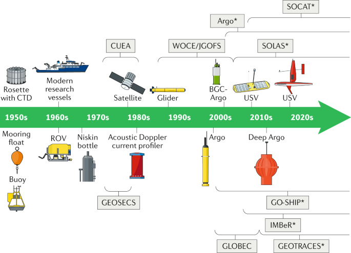
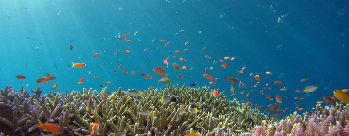
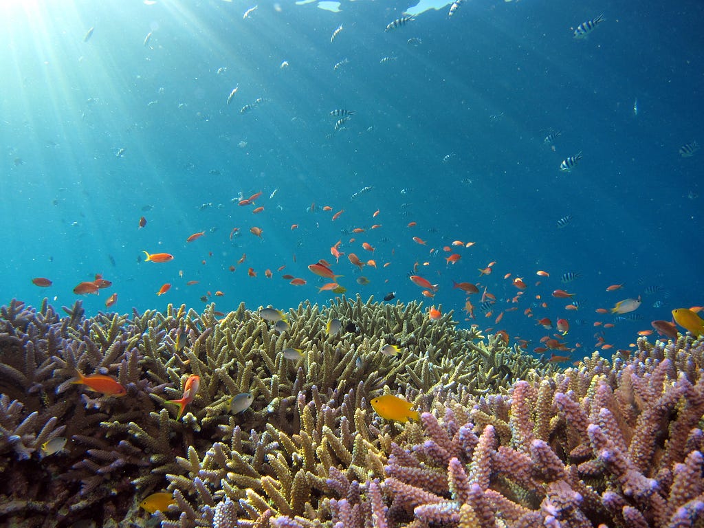
This op-ed is recognized as the Best Call to Action in the annual Berkeley MEng op-ed contest and part of a series from E295: Communications for Engineering Leaders. In this course, Master of Engineering students were challenged to communicate a topic they found interesting to a broad audience of technical and non-technical readers. As an opinion piece, the views shared here are neither an expression of nor endorsed by UC Berkeley or the Fung Institute. Aboard the MV Resolute, a recreational dive vessel, we had just left the dock en route to Tubbataha Reefs in the Philippines. Tubbataha was described to me as the dive site of a lifetime: clear, turquoise blue waters hiding unspoiled coral reefs, sharks, sea turtles, and manta rays. As we started to sail some 13 hours into the blue expanse, ready for adventure, we were told that while forecasts for the area were clear skies, predictions weren’t always accurate. “Because” the crew asked, “who cares about the weather in Tubbataha? The five rangers stationed there?” As the land disappeared into the horizon behind us, I couldn’t help but wish we knew if storm clouds would greet us on our arrival and how literal the words “trip of a lifetime” would prove. Predictions about our oceans go beyond just making sure it doesn’t rain during a dive trip (God forbid I get wet while jumping into the waters!). The Blue Economy, which comprises all marine-based industries, is expected to contribute 3 Trillion USD to the global economy in 2030, double the number from 2010, according to the Organization for Economic Co-operation and Development. We rely on our oceans for food, tourism, shipping, and more. Predicting the behavior of our oceans would lead to huge benefits for these industries. But understanding our oceans goes beyond just maximizing dollars and cents. Figure 2 (below) shows a heatmap of tropical cyclone intensity from 1851–2006. The greatest concentration, the red splotch in the Western Pacific, is where I’m from — the Philippines. Five of the ten deadliest tropical cyclones in the 21st century affected the Philippines, with Time Magazine calling it “the most exposed country in the world to tropical storms.” Growing up, I’ve seen typhoons destroy crops, flood highways, and level entire cities, taking everything from people around me. Gathering better data on wind, temperature, pressure, salinity, and many other variables from our vast waters can help us better forecast hurricanes and typhoons, aiding evacuations and preparations for areas most prone to these natural phenomena. But gathering that data needed is no easy task. The Deep Blue has no cellular reception, power outlets, or even a solid place to build or anchor sensors. Strong winds, huge waves, and sometimes curious, sometimes aggressive wildlife also come into play to make for one of the most unforgiving environments on the planet for electronic equipment. Over the decades, we’ve made huge leaps in technology to better sense the ocean. Figure 2 (below) shows a timeline of milestones for oceanography. At the dawn of modern oceanography in the 1950’s, scientists collected data with high touch methods, venturing into the seas and deploying sensors: Niskin bottles and rosettes which collect seawater, remotely operated underwater vehicles (ROVs), and doppler devices which measured currents. These methods are expensive and slow; there are only finite oceanographers in the world, and thousands of square kilometers to cover. To get accurate predictions, data would need to be collected consistently and remotely. Moored buoys, stationary devices equipped with an array of sensors, can gather data reliably, without much need for human intervention. But these stations need an anchoring point, prohibiting placement in many parts of the ocean. Satellites, which were used for oceanography starting in the 70’s, could collect data from remote locations where moored buoys could not, but can’t measure as frequently due to their movement while orbiting. Readings from satellites are also obscured by clouds, which limit the reliability of data. Drifting floats, such as ones from the Argo Program, are sensors that are deployed with no anchor; they move along with ocean currents. These devices can get frequent readings from remote locations in the ocean without being obscured by clouds. While floats have provided valuable data to scientists, the limitation is that we can’t control where these sensors go; they’re at the mercy of the waves. To gather rich data, in remote locations, on demand, we need a technology that is deployed, mobile, and controllable. This is where unmanned drones come in. While underwater gliders, fitted with wings to give limited mobility, have existed since the 1980’s, it’s only with recent technological developments in battery technology, electric motors, and cost-effective controllers, that we’re seeing a huge emergence of ocean drones. In 2021, vehicles from the Saildrone company traveled into the category 4 Hurricane Sam to collect crucial data on hurricane formation — advancements that could improve the climate resilience of at-risk countries, like my home of the Philippines. Ocean drones like these will usher in a new era for oceanography and bring a greater understanding of our oceans. Back on the Resolute, we saw no storm clouds at our destination. Instead, we saw the unspoiled coral reefs, sharks, sea turtles, and manta rays that we came for. I had fallen in love with the ocean. This passion made me want to understand our waters, and care what happens to them. Like many of us, I grew up learning that our oceans cover 70% of our planet. Initially that statistic struck awe in me, at how expansive our oceans are.“I eventually realized that it meant that if we were to understand and care for our planet, we would have to understand and care for our oceans.”So if you’re one of us looking to do something to save our planet, I urge you to not overlook our waters. I urge you to fall in love, like I have, in the ocean. Go to the beach. Feel the sand crunch beneath your feet. Take a dip. Dive in. See the corals. Drift with the currents. When you fall in love with the Blue, you’ll want to understand it more. Then you and I can both care if it rains on our oceans. References
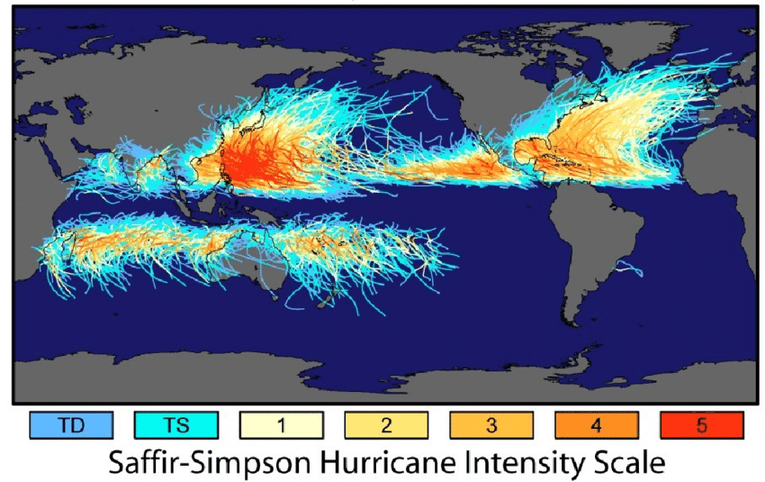
- Saving the Planet with Appropriate Biotechnology: 3. The High Seas Solution — Scientific Figure on ResearchGate. Available from: https://www.researchgate.net/figure/Global-distribution-of-the-tracks-and-intensities-of-all-tr opical-storms_fig5_347564174 [accessed 11 Nov, 2022]
- 2. Chai, F., Johnson, K.S., Claustre, H. et al. Monitoring ocean biogeochemistry with autonomous platforms. Nat Rev Earth Environ 1, 315–326 (2020). https://doi.org/10.1038/s43017-020-0053-y
Op-ed: Who cares if it rains on the ocean? was originally published in Berkeley Master of Engineering on Medium, where people are continuing the conversation by highlighting and responding to this story.